
ParcelQuest Gateway
ParcelQuest Gateway is a continuously updated feature service providing parcel boundaries, ownership, zoning, and attributes for 13+ million California parcels, delivered directly into your GIS environment.
ParcelQuest is already the most trustworthy, comprehensive, and up-to-date California property data source in the known universe. And now, with ParcelQuest Gateway, we might be the most convenient, too.
Once you subscribe to Gateway and load it into your GIS environment, you’ll have instant, always-current access to superior data, from owner names and parcel boundaries to zoning information and air parcels.
In My GIS
Gateway’s data is

Accessible directly in Esri and compatible open-source programs

Updated daily

Straight from the County Assessor

Available at a statewide or county-by-county level

More comprehensive and accurate than any competitor
People are saying…
Testimonials
Core Data
- Parcel boundaries (statewide or county)
- Owner names & addresses
- Parcel characteristics & air parcels
Zoning Intelligence
- Parcel-level zoning codes
- Descriptions & jurisdictions
- Standardized across county lines
- Manually interpreted where GIS data is missing
Delivery & Access
- Insight into your GIS environment
- Available statewide by county by county
- Automatic updates – no file management
- Managed by our in-house GIS Team
- In-house Gateway Support Specialist
Powering your GIS decisions with better data
Still relying on outdated, misaligned data and telling yourself it’s “good enough”? That’s like driving blindfolded around a curve and hoping for the best. You wouldn’t do that—and you don’t have to with your GIS data, either.
Backed by decades of GIS mapping, data collection, and standardization expertise, ParcelQuest delivers the most authoritative, continuously updated California parcel boundaries, owner names, addresses, and characteristics directly into your GIS environment.
Features
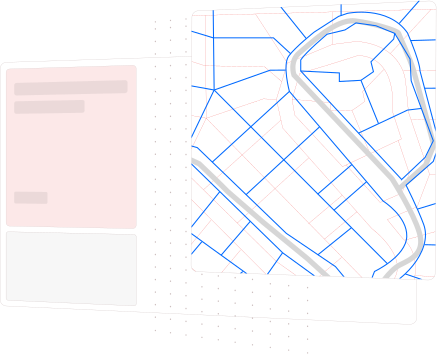
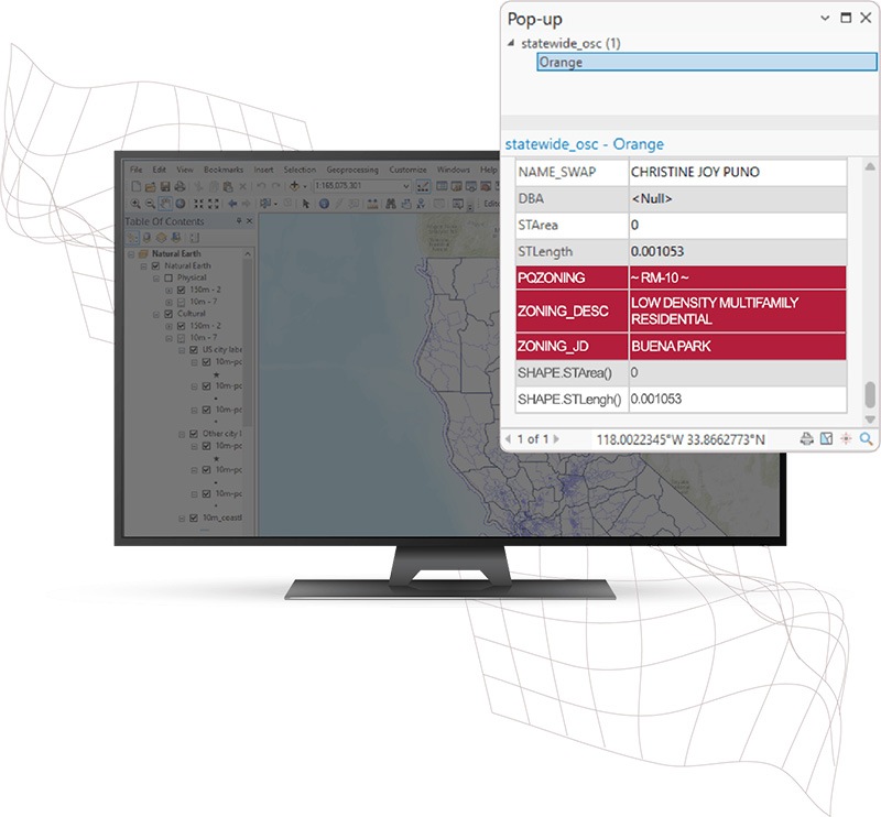
Standardized Zoning Information Across City and County Lines
Gathering current zoning data from more than 500 municipalities across California is impressive on its own. But the real magic happens when that chaos is transformed into accurate, parcel-level zoning for all 13+ million parcels statewide and kept continuously up to date.
The PQ GIS team starts by overlaying every available zoning layer onto our daily-updated parcel base, resolving misalignments and inconsistencies along the way. Our team then interprets and applies every applicable zoning code to each parcel with precision. When GIS data doesn’t exist, we roll up our sleeves and manually assign zoning directly from source documents.
The result? A clean, statewide zoning layer that clearly defines boundaries and intent. All parcel level zoning codes, zoning descriptions, and associated zoning jurisdictions are then delivered seamlessly inside ParcelQuest Gateway, turning one of the most complex datasets in California into something powerful, reliable, and easy to use.
Features

See Gateway in Action
Check out everything you can do with ParcelQuest Gateway.
Frequently Asked Questions
FAQ
Since 1995, ParcelQuest has worked directly with California County Assessors and other local, state, and federal agencies to collect, standardize, and publish daily updated property-related content through various tools and services. ParcelQuest also has an in-house team of Cadastral Mappers and GIS Specialists that uses industry best practices and ethics standards. As a result, ParcelQuest produces the only statewide GIS parcel boundary layer in existence that is updated daily with newly created parcels and rapidly changing ownership data.
If you’re not using Gateway, you’re working too hard.
Call us for a custom quote at 1-888-217-8999
Or, fill out the form below to let us know what you’re looking for and how you’re currently using Esri products, and we’ll get in touch with ways to help you get the most from your California parcel data experience.