


Exports & Reports

Generate reports and export our data. Then generate a pat on the back.
Get more out of PQ Online by putting our data, mailing lists and files into your own application, labels, report, spreadsheets or presentations.
sign upExports
Export the data you’ve accessed in PQ Online right where you need it.
Mailing Labels
Once you’ve created your property list, create labels with the mailing address of the owner or the physical address of the property, with or without the APN.
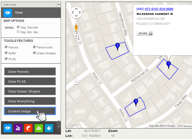
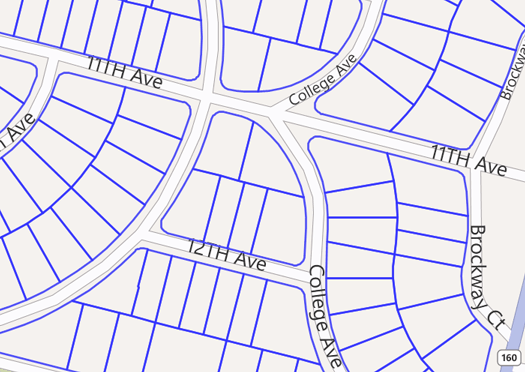
Images
Use the Save Current Image feature to create an aerial photo or street map overlaid with your selected parcels and other informational layers.
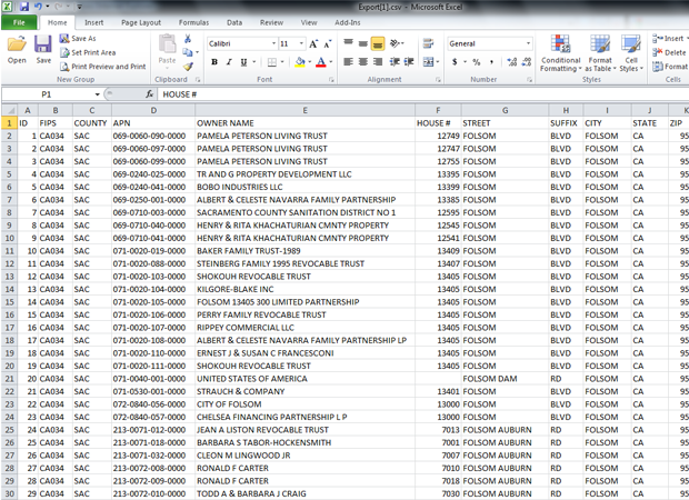
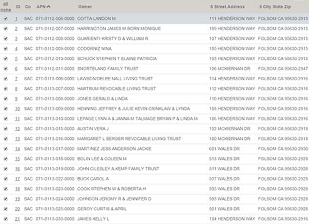
Spreadsheets
Export select data into an Excel Spreadsheet.
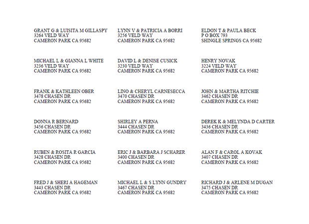
Mail Merge
Export names and addresses for merging into letters and other documents.
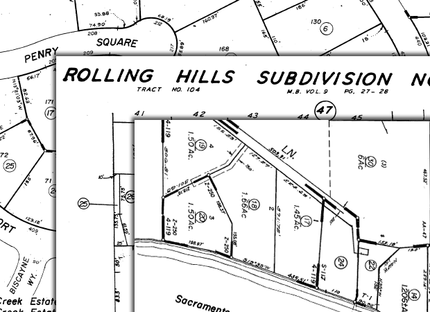
APN Maps
In a single step, extract APN maps associated with parcels in your results list.
GIS Shape Files
Export parcel boundaries into a shape file compatible with your GIS system.
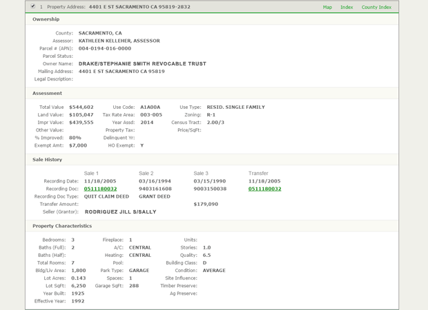
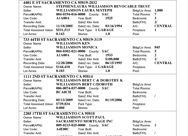
Reports
All our reports can be downloaded as a .pdf, and we’re always making new reports available.
- Detailed profiles for every parcel
- Short reports with abbreviated information for up to five parcels per page
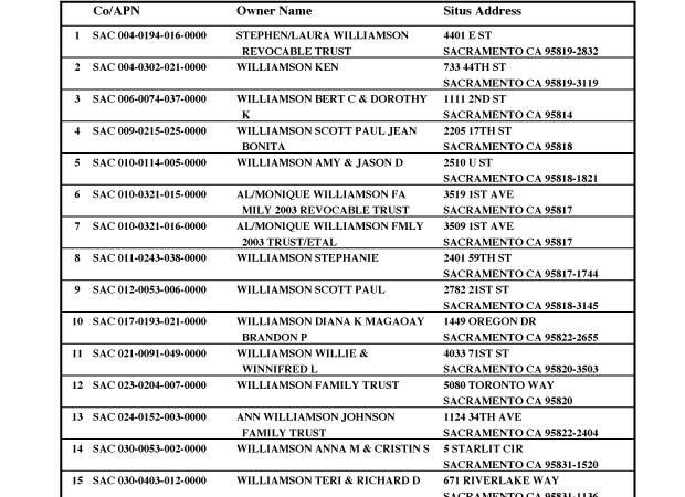
- List reports showing the APN, ownership and address for up to 30 parcels per page
- Mailing lists
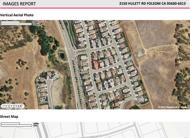
- Images – Shows the official boundary of your parcel on both the aerial photo and street map
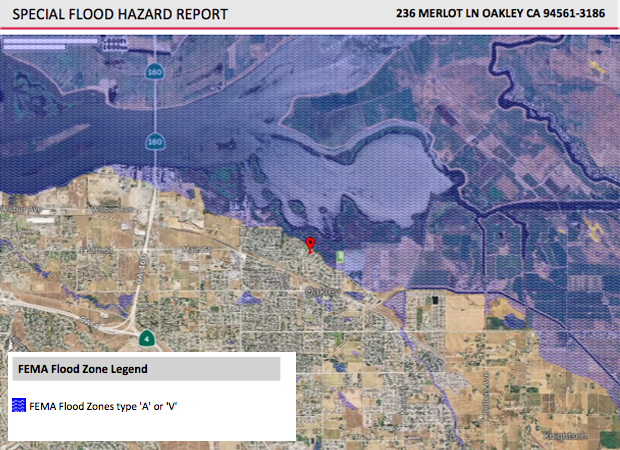
- Flood Hazard – See how close your parcels of interest are to the FEMA flood zones
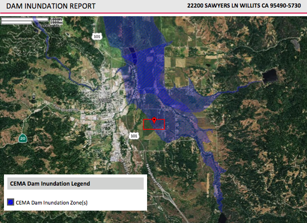
- Dam Inundation – See your parcel of interest in context of the CA Emergency Management Agency (CEMA) Dam Inundation zone(s)
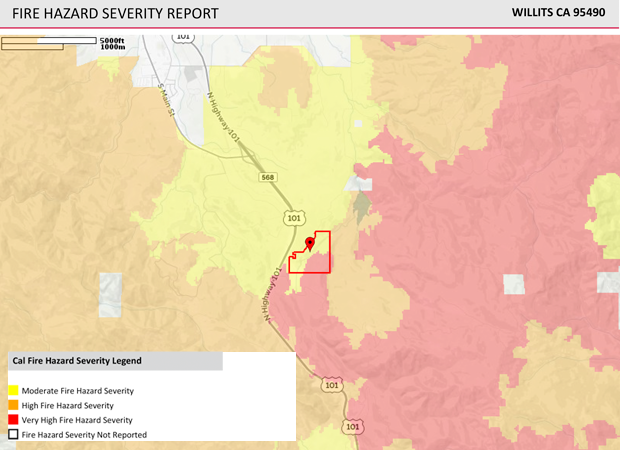
- Fire Hazard Severity – Overlay CalFire Moderate, High and Very High Severity Zones
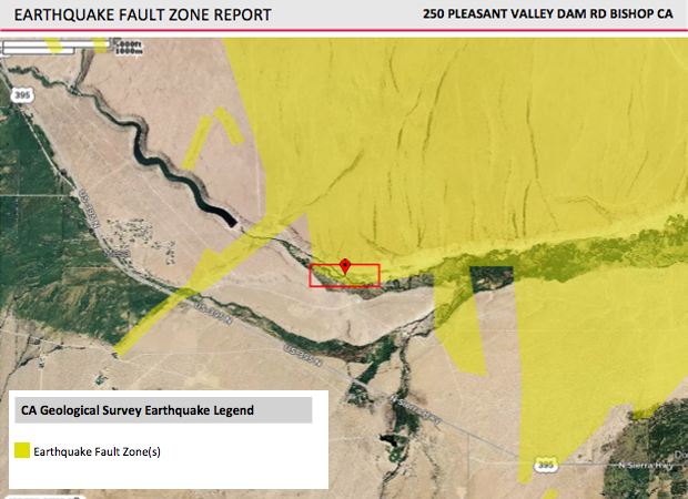
- Earthquake Fault Zone – See your parcel(s) of interest in context of the U.S. Geological Survey Earthquake Fault Zone
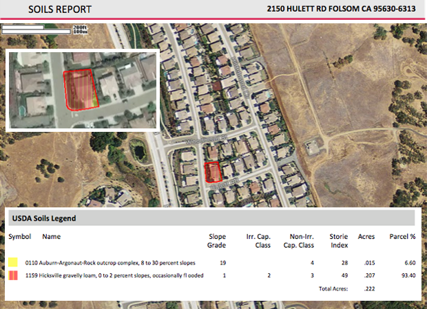
- USDA Soil Survey reports – PQ Online matches parcel shapes with an overlay of soil types, slope, Storie index, quantity of each soil type in acres and as a percentage of the property
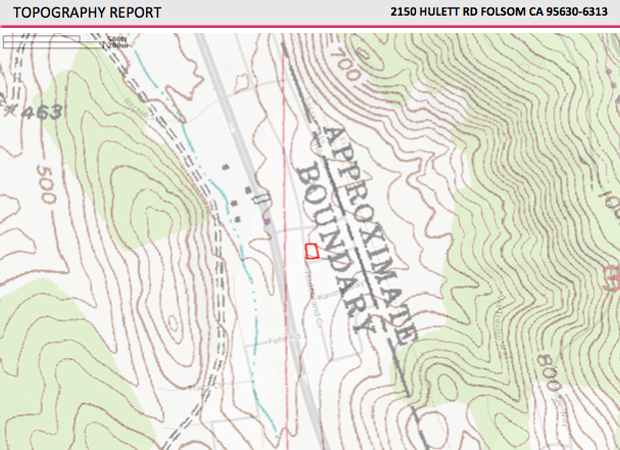
- Topography report – See your parcel in relation to the U.S. Geological Survey topography layer
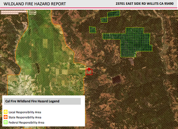
- Wildland Fire Hazard – See if your parcel is in a local, state, or federal responsibility area for wildland fire suppression
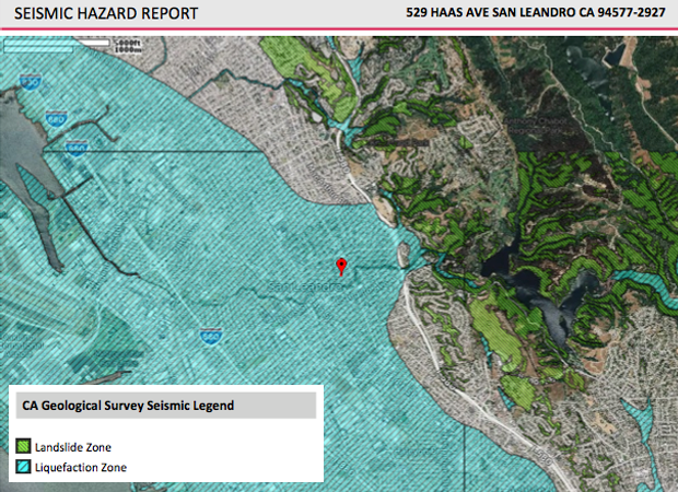
- Seismic Hazard – Displays the U.S. Geological Survey Landslide and Liquefaction Zones
Other Features
-

Parcel Search
Find all the property data you need with just an APN or address.
learn more → -

APN Maps
Our parcel maps are high-resolution, interactive, exportable, and measurable.
learn more → -

Property Owners
Verify ownership data, addresses, and multiple properties with one click.
learn more →