Get Zoning Data for Thousands of Parcels Without Breaking a Sweat
Imagine this. You’re a big-time developer or real estate investor looking for the perfect land to build your dream project on. You have some promising parcels in mind, but before you get too excited you know you have to check the zoning regulations for each one. And because they’re spread out across the state, you have to pull up websites for multiple municipalities. Every one of them is laid out differently.
You spend your morning clicking through dozens of links to find the right pages, looking up what different codes mean, and cross-referencing the zoning maps with the parcel maps to make sure it even makes sense. By the time you’re done, your coffee has gone cold and your computer is struggling under the strain of a few dozen open tabs. You’re daydreaming about changing careers to shepherd in the Swiss Alps just so you never have to look at another California zoning map again.
You could certainly do that.
But we have a better idea.

Introducing PQ Zoning, Your One Stop Shop for Parcel Data
Until now, there has never been a service to connect California parcels with their matching zoning codes. All of that information has always lived separately with the county, forcing anyone who needs zoning information to wade through the tedious process of finding a parcel, matching it to the same property on a zoning map, and then looking up the relevant codes.
That might not be so bad if you only have one property to search, but it turns into a real headache if you’re working with a lot of properties, especially when they’re scattered across multiple counties.
ParcelQuest Zoning brings all of the data you need into one convenient online environment. And best of all, it’s already available for any ParcelQuest user at the Aviator level.
What You Get When You Use PQ Zoning

We’ve spent the last several years collecting accurate zoning codes for over 500 municipalities across California, overlaying zoning maps against our ParcelQuest parcel layer, and importing all of that matched-up information into ParcelQuest.
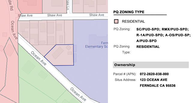
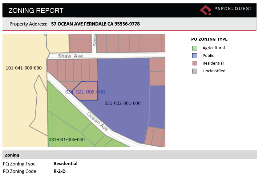
What that means for you is you can easily find a parcel, run a PQ Zoning report, and instantly see the relevant zoning codes alongside the ownership information, assessment detail, and sales history. The reports also include the zoning information for adjacent parcels.
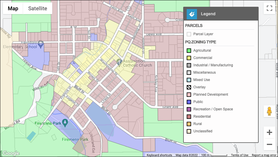
We’ve also aggregated all of the numerous zoning codes into a single categorical system that consists of twelve PQ Zoning types. Now, there’s no more confusion about how “R” stands for Residential in one county and Rural in another. You can search for parcels using the PQ Zoning type and even overlay the PQ Zoning type layer against the ParcelQuest parcel layer on the integrated Google Map for easy reference!
PQ Zoning is currently available for 29 counties, and the rest are coming soon.

Why Are You Wasting Time With Inferior Parcel Data?
ParcelQuest is the most accurate, most up-to-date, most humble source of California parcel data in the universe. We live and breathe parcel data so that you can get what you need in a couple minutes and a few clicks.
We’re always listening to what our users need, where their pain points are, what’s bothering them, and what they’ve always dreamt of in a parcel data provider. If you have ideas or suggestions for what could make ParcelQuest even better, give us a call at 888-217-8999. Or, sign up today at the Aviator level to begin using PQ Zoning right away.