I’m a Surveyor or Civil Engineer — What Can ParcelQuest Do For Me?
Successful projects rely on good engineering. Civil engineers rely on super-accurate land surveying. And land surveyors rely on ParcelQuest!
We’ve got data on 13 million parcels in all 58 counties, and we update it every single day to make sure you’ve got what you need, when you need it, in the format you need it, every time. It’s what we live for, really.
Inaccurate Project Data is a Nightmare
An entire transmission project can come to a screeching halt when the data is out of date. What if you’re trying to contact the wrong property owner? What if you’re working with inaccurate document numbers? Incorrect boundary lines? Nobody wants to be like the engineer who built a $2 million home on the wrong lot.
Sure, We’ve Got Parcel Data. What Do You Want to Know?
Does the parcel exist in California? Do you need data on it? We’ve got you covered. Surveyors and engineers on our platform get instant easy access to:
-
Property ownership information:
Easily find the owner names and addresses, synced to county assessor records, to make identifying and contacting property owners for permissions and notifications a breeze. Planning to put in a new utility line? Search by location to find owner data for every person in the installation path in one search.

-
APN/doc search:
If you know the Assessor Parcel Number for a property, you can search for all the data we have for that parcel with our handy APN search feature. Need to search for a recorded document? You can do that, too. You can also search recorded documents by document book and page, official record, or by parcel or record map.

-
Parcel boundaries:
Carpenters measure twice and cut once. Land surveyors check parcel boundaries as many times as they need to. Quickly check for the boundary lines of the parcel of your choice, run buffer searches on your custom drawn shapes, and save your shapes down for future searches.
-
GIS map layers:
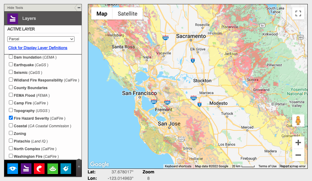
Street map? Aerial photo? Fire and flood zones? Parcel boundaries? Earthquake zones? Soil surveys? How about all of the above and more besides! If a layer is available, you can easily toggle between views in our visual layer library. Cross-check the information you need without having to search for the data separately.

That’s just scratching the surface. We’re constantly updating and expanding our visual layer library, and we’re here to serve your needs – so if you need something particular that we somehow don’t have already, we’ll work to make that happen.
Why PQ Data is Superior
Sure, you could find everything yourself. If you’re willing to pack up, drive to the county assessor, spend an afternoon digging through archives, and give yourself a headache trying to cross-reference dozens of pieces of data.
Or, you could let us do that. Because we love it. And we have nothing better to do, unlike you. You’re probably really busy.
Our information comes directly from the source. We take county assessor data, catalog it, store it, scrub it for mistakes and errors, and update it daily to be sure it’s all exactly right. We’ve got comprehensive data sets for 13 million and counting parcels in all 58 CA counties, and you can access all of it with a quick search and a couple mouse clicks.
So what are you waiting for? Sign up today to gain access to all of this, then go do something nice for yourself to celebrate. Your projects are about to get so much easier.